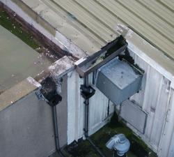
Drone Services Ireland - Residential Inspection
Price: CALL FOR ASSISTANCE
Drones have many uses for residential and commercial customers, from high roof inspections to guttering, a high-resolution map of the roof can be created, that can be zoomed and examined later. Current Aerial imaging cameras are capable of producing very high-resolution images which can be stitched together to create a map of an area or object.
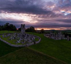
Drone Services Ireland - Aerial Photography
Price: CALL FOR ASSISTANCE
Drone Services Ireland shoot professional aerial photography and video using the latest in drone technology to bring you ultra-high-resolution photos and video. All of our aerial photography images are shot in RAW format allowing us to capture the full dynamic range that the DJI X5S allows. We are also able to change lenses, to allow varying focal lengths enabling us to capture a unique shot for each situation.


