Autonomous Mapping and Inspection Robotics with Automated Analytics
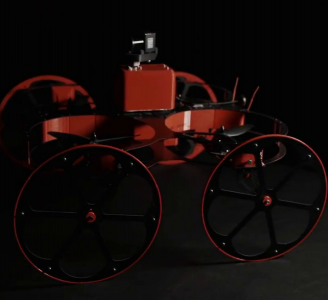
Inkonova offers real-time, underground mapping and data acquisition technologies unlike any other. Safe and efficient inspection, mapping, and data capture underground is now possible with our real-time, 3D visualisation innovations. Our agile, smart-drone technologies give you real-time access to areas that range from just below the surface, to deep, dangerous, and previously inaccessible. We utilise non-GPS localization, SLAM, and 3D pointcloud generation tools. Unleash your team’s exploration capabilities with Inkonova.
The most cost-effective and time efficient way of inspection, mapping & data acquisition in underground mining:
- Real-time laser mapping, the complete solution for underground exploration
- Access GPS-denied, constricted and inaccessible zones
- Laser based Beyond-Line-Of-Sight (BLOS) operation with Dual SLAM
- Integration in mining automation systems and routine flights
What we do
Inkonova has pioneered the only real-time mapping and data acquisition tools for underground mining. Our technologies are the most cost effective, agile, and time-efficient tools available on the market to survey and visually inspect underground tunnels and formerly inaccessible areas. Exploring beyond-line-of-sight gives true all around awareness.
Operational benefits
Simultaneously survey and map underground while tracking your device beyond line-of-sight. Mapping remote areas is now a quick, simple, and affordable process! Inkonova’s real-time mobile-mapping offers many operational benefits:
- ACCESS THE INACCESSIBLE
- REDUCE CARBON FOOTPRINT
- INCREASE SAFETY OF HUMAN WORKFORCE
- INCREASE OPERATIONAL
- EFFICIENCY & EFFECTIVITY
- REDUCE OPERATIONAL COSTS
- OPTIMISE PRODUCTION FLOW
- ACCELERATE PRODUCTION TIME
- MINIMISE EXPLORATION RISKS
- OPTIMISE SEARCH & RESCUE MISSIONS
- UNLOCK FULL POTENTIAL OF INACCESSIBLE AREAS


