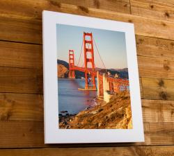
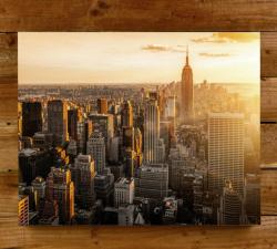
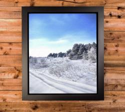
One Vision Imaging - Coloured Edge Blocks
Price: CALL FOR PRICE
This simple yet effective wall display product is created by first printing a high-quality photograph.
Caelus Drones - Photography & Media
Price: CALL FOR ASSISTANCE
The original application for drone services!
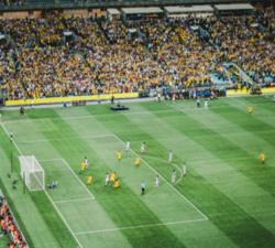
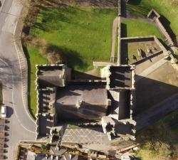
Skeye - Aerial Tours
Price: CALL FOR ASSISTANCE
An impressive Skeye product is the 360 degree panoramic tour. Recorded from the sky in combination with additional footage on the ground. This looks like Google Streetview but from the sky.
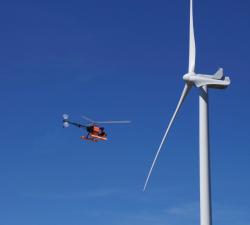
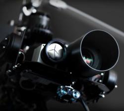
Aero Enterprise - Inspection
Price: CALL FOR ASSISTANCE
All high-resolution image data of the inspected objects are recorded using the self-developed AERO-SensorCopter®, which is specially designed to perform under harsh offshore weather and wind conditions.
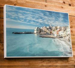
One Vision Imaging - Canvas Wraps
Price: CALL FOR PRICE
This modern, stylish, award-winning Canvas Gallery Wrap is the perfect way to display your images.
One Vision Imaging - Framed Coloured Edge Blocks
Price: CALL FOR PRICE
The print is flush mounted onto a thick MDF block and an anti-scratch print seal is applied to its surface.
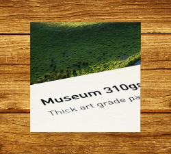
One Vision Imaging - Fine Art Prints
Price: CALL FOR PRICE
Giclée printing is used by many museums and art galleries throughout the world for its unique, painterly qualities. Images take on a watercolour-like look, with the texture of the paper helping to add to the overall pleasure of the photo or artwork. Images are taken on a more matte appearance, with deep blacks, bright whites and more bright pastel-like tones to images.
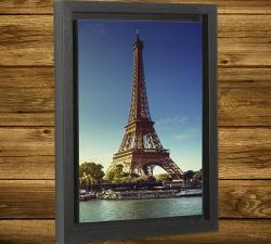
One Vision Imaging - Box Frames
Price: CALL FOR PRICE
Simple yet elegant best describes the ever popular Box Frame.
One Vision Imaging - Framed Canvas Wraps
Price: CALL FOR PRICE
This modern product is made by photographically printing your image, applying a canvas effect seal, wrapping it around a 2" block then framing the canvas wrap using either a high gloss black or white inlay frame.
Digital Drone Services - Aerial Photography
Price: CALL FOR ASSISTANCE
Like a scene taken from a different angle? This is your solution.
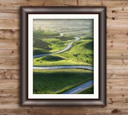
One Vision Imaging - Framed Prints
Price: CALL FOR PRICE
As one of the UK's top photo printers and photo frame makers, we understand that key to any photo framing service is ensuring you use top quality raw materials from the world's best suppliers, utilise precision manufacturing equipment and employ master craftsmen with years of experience to bring it all together. Our print and print framing turnaround times are industry leading and our returns from manufacture defect are at less than 1%.
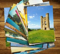
One Vision Imaging - Photographic Printing
Price: CALL FOR PRICE
Here at OVI, we believe photo image quality is everything. We have spent the last 40 years updating and refining our processes, from unique colour grading, density and contrast controls to only printing on the very best Fuji gallery grade photo and Hahnemüle Fine Art Giclée papers.
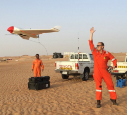
Aero Enterprise - Engineering
Price: CALL FOR ASSISTANCE
Aero Enterprise supports the customer during UAV projects like development of special UAVs, certificates of airworthiness and documentation as well as external payloads.
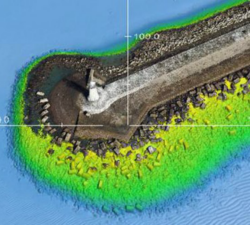
Skeye - Digital Terrain Models
Price: CALL FOR ASSISTANCE
Skeye specializes in making aerial photographs at low altitude with a geometrically calibrated camera. This enables us to obtain all heights, of a landscaped area. At each height (Z) the coordinates (X, Y) are also recorded. This creates a digital terrain model that can be calculated quickly and accurately. The volume of a stockberg can be calculated relative to a base plane or if two measurements take place at different times, a difference calculation can be made.
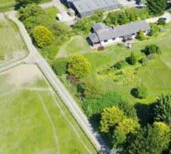
Skeye - Aerial Surveying & Mapping
Price: CALL FOR ASSISTANCE
Skeye uses drones (small unmanned helicopters and aircraft) to make aerial photographs at low altitude. With these pictures we make 3D digital height and terrain models and orthophoto mosaics (underlayers images).
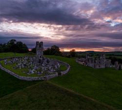
Drone Services Ireland - Aerial Photography
Price: CALL FOR ASSISTANCE
Drone Services Ireland shoot professional aerial photography and video using the latest in drone technology to bring you ultra-high-resolution photos and video. All of our aerial photography images are shot in RAW format allowing us to capture the full dynamic range that the DJI X5S allows. We are also able to change lenses, to allow varying focal lengths enabling us to capture a unique shot for each situation.
The Drone Guys - Photography and Video Filming
Price: CALL FOR ASSISTANCE
Being able to fly a drone doesn't make you a drone photographer .. Luckily The drone Guys are a group of highly skilled and professional photographers. Along with being skilled drone pilots they know exactly how to get that professional shot that is required by our clients. Using the most up to date equipment and post processing techniques to get you exactly what you need from the air.
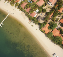
Skeye - Aerial Photography
Price: CALL FOR ASSISTANCE
Skeye BV provides aerial photography throughout the country, both in urban and rural areas. Due to our wide variety of possibilities and materials we can always deliver. We always produce the desired result through the deployment of drones, manned airplanes, helicopters and aerial platforms.
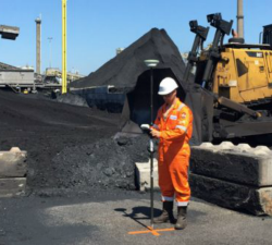
Skeye - Volume Computations
Price: CALL FOR ASSISTANCE
Skeye specializes in the accurate measurement of stocks or mountains stored material using unmanned helicopters (drones). These are equipped with a 36Mp digital camera and geometrically calibrated to perform measurements. These measurements are based on the photogrammetric principle whereby terrain heights can be calculated in the overlapping portion of photographs taken from another point of view.
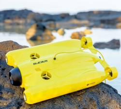
GeoAccess - Underwater Inspections
Price: CALL FOR ASSISTANCE
Once the preserve of traditional remotely operated vehicles (ROVs), GeoAccess can now offer underwater inspections, photography and video with our submersible drone, the Chasing-Innovation Gladius V2. We strongly believe that we can offer a cost-effective, comprehensive underwater inspection service, providing high-resolution photography and 4K video, without compromising quality and safety, and without having to rely on larger, cumbersome, less manoeuvrable ROVs.
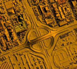
Skeye - Orthophoto Mosaics
Price: CALL FOR ASSISTANCE
Skeye uses unmanned helicopters and aircraft for low-altitude aerial photographs. This enables us to work quickly, flexibly and cost-effective. This low altitude delivers unique and sharp images on which all the details can be seen.

Scopito - Drone Inspection Software
Price: CALL FOR PRICE
Scopito is simple to use and can be accessed from many different types of devices. In the field or in the office you have the ability to analyze, visualize and apply tags or comments to your images from a variety of portable devices, as well as standard laptops and desktops.