SkyWatch.AI Drone Insurance On-Demand - SkyWatch.AI
Price: CALL FOR ASSISTANCE
Safer Pilots Pay LessSkyWatch.AI provides the world’s first Usage-Based Drone Insurance & Safety app. The mobile app utilizes a variety of data sources to analyze and actively reduce drone flight risks, including drone telemetry hyper-local weath
D-RisQ - Clawz
Price: CALL FOR ASSISTANCE
The manual generation of code is inevitably fraught with errors leading to expensive re-work. Even if code is automatically generated unit test is required to demonstrate that the code is error free and further tests must show that it implements the software design. CLawZ® avoids the time and cost of undertaking unit test because it automatically proves that the automatically generated code correctly, completely, and accurately implements a design generated in Simulink.
Unifly - Unifly BLIP
Price: CALL FOR ASSISTANCE
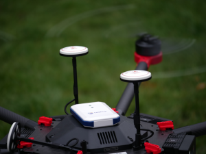
Drone tracking and e-Identification Unifly has developed a drone tracking and e-Identification product: the Unifly BLIP. This stands for Broadcast Location & Identification Platform. BLIP is tailored to the specific needs of UTM service providers, local authorities and drone operators.
Unifly - Unifly User Tools (UTM)
Price: CALL FOR ASSISTANCE
Unifly’s Unmanned Traffic Management (UTM) platform connects official entities with operators to integrate drones into the airspace safely and securely.
Aero Enterprise - Aero Enterprise Partner Program
Price: CALL FOR ASSISTANCE
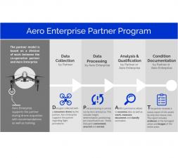
The partner program is based on a division of labor between the co-operation partner and Aero Enterprise. The Partner uses his own conventional DJI drone equipment on site.
Data-Shack - Analytics Software
Price: CALL FOR ASSISTANCE
ProfessionalProfessionalIdeally used by researchers, data scientists and business analysts.Built-in SmartsBuilt-in SmartsDrag and drop workflow interface to deliver analytic resultsWizard and guided analytics availableSimplified Data Preparation and AggregationSimplified Data Preparation and AggregationAutomatic health check, mashup and aggregationApp Marketplace IntegrationApp Marketplace IntegrationApervitaAlgorithmia
GeoAccess - Asset Management Software
Price: CALL FOR ASSISTANCE
GeoAccess utilises Pole Star Infrastructure Asset Management software in all our operations. Pole Star systems currently provide key solutions to Network Rail, Highways for England, the renewable energy sector, ADIPS (theme park inspections), the petroleum industry and utility companies.
Aero Enterprise - Aero-Software Package
Price: CALL FOR ASSISTANCE
The self-developed AERO-Software Package enables an efficient asset management with AERO-View - for a preview of the results – and AERO-Lyse – for allocation of anomalies, assessment of damages and documentation.
YellowScan - CloudStation - Turn physical projects into digital realities
Price: CALL FOR ASSISTANCE
YellowScan - CloudStation - Turn physical projects into digital realities
Price: CALL FOR ASSISTANCE
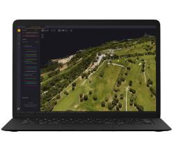
The CloudStation is an evolutive and user-friendly software, developed by YellowScan, to generate and visualize pointclouds.Want to try CloudStation? Take advantage of our 30-day trial!
Unifly - Unifly Supervisor portal
Price: CALL FOR ASSISTANCE
The Unifly database contains all the data needed by authorities to visualize and manage the airspace and unmanned traffic.


