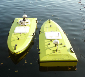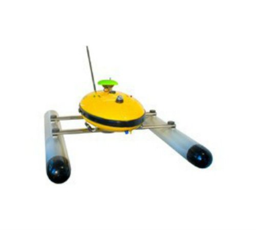
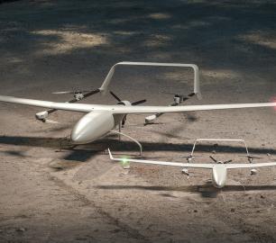
AiDrones - Sonoboat
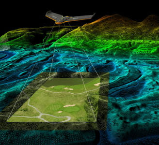
The Sonoboat is a cartographic surveying vehicle, capable of autonomous and remotely controlled operation. It is ideal for missions in hard to reach or dangerous locations. The ease of deployment and compact size significantly reduce the costs of waterbody mapping and similar applications.
The Detail
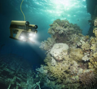
Additionally to all the innovative features of the vehicle itself, it integrates the most advanced acoustic sensor technology, capable of measuring sediment thickness, providing 3D surface profiles, material composition analysis and structural integrity, without the need for direct contact to the analysed objects. Other sensors can be integrated on demand.
Groundbreaking:
Advanced spectral analysis featuring acoustic material recognition for the first time
Material and structure recognition even from the distance
High precision:
Differential GPS for high accuracy cartography (GPS, GLONASS and ASCOS)
S2C ultra-broadband Echosounder (depth measurement accuracy +- 1,5 cm, min. depth 1m)
Sidescan Sonar option
Versatility:
Autonomous and radio controlled operation modes
Multiple communication options: Wi-Fi, GPRS/UMTS, RC
Onboard data logging, transmission on demand
Adjustable width for increased stability when there are waves
Flexibility:
Integrated camera for operation in remote locations and surveillance
Fast access to points of interest, precise manoeuvres and efficient area scanning thanks to gently controllable hydro jet thrusters
Batteries for up to 10 hours operation
Software for field operation and data processing with visual georeferenced representations
Easy to deploy
From the start, the Sonoboat was designed focusing on ease of use and deployment. It can be transported in the back of a normal car and assembled by a single person. Thanks to special fasteners that can be adjusted by hand there is no need for tools. Once on site Sonoboat can be operated autonomously travelling a pre-programmed track or be remotely operated by either radio frequency, wireless LAN or a GPRS/UMTS network. The on-board data-logger collects and geo-references all the information captured by the sensors. Real-time data transmission can also be performed depending on the selected interface and conditions.
You may also like
ALTI
Reach - VTOL UAV
CALL FOR ASSISTANCE
The ALTI Reach is the upcoming 'bigger brother' to the ALTI Transition.
Product DetailHeven Drones
H100
CALL FOR ASSISTANCE
The H100 represents the beginning of Hevens heavy lifter drones.
Product DetailHeven Drones
Urban Heven
CALL FOR ASSISTANCE
The Urban Heven is an advanced stage hexacopter drone capable of serving multiple mission types.
Product DetailTeal Consulting

Developing Collaborative Business Relationships
CALL FOR ASSISTANCE
Developing Collaborative Business Relationships - ISO 44001Organisations have long recognised tha
Product DetailValqari
Valqari Single Locker (DevKit) Drone Delivery Station
CALL FOR ASSISTANCE
The Valqari single locker (DevKit) drone delivery station, enables full autonomous point-to-poi
Product DetailAiDrones
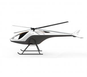
AiD-H85
CALL FOR ASSISTANCE
The AiD-H85 is a versatile RPAS (Remotely Piloted Aerial System) helicopter featuring an intermes
Product DetailDRONE TRACKING TECHNOLOGIES
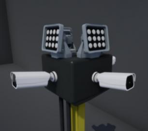
The F-Series VAD drone detection system
CALL FOR ASSISTANCE
The F-Series VAD drone detection system.
Product DetailHeven Drones
H250
CALL FOR ASSISTANCE
The H250 will be the workhorse of Heven’s heavy lifting drones.
Product Detail
Teal Consulting

Operational Excellence
CALL FOR ASSISTANCE
Teal Consulting - Operational ExcellenceOperational excellence is crucial to businesses achieving
Product Detail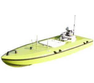

tlmNexus Ltd
EVIDENCE DOCUMENT BUILDER
CALL FOR ASSISTANCE
Tool overview: what will Evidence Document Builder (EDB) solve for me? Complying with t
Product Detail
tlmNexus Ltd
RESOLVE
CALL FOR ASSISTANCE
Tool overview: what will Resolve solve for me?Equipment issues that affect airworthiness, saf
Product DetailtlmNexus Ltd
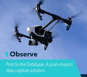
OBSERVE
CALL FOR ASSISTANCE
Tool overview: what will Observe -Post-Sortie Database solve for me?Designed by pilots for pi
Product Detail
Microbyte Solutions Ltd
White Label 24/7 IT Helpdesk
CALL FOR PRICE
You can outsource your IT Helpdesk from only £500 a month.Microbyte White Label boosts your suppo
Product Detail