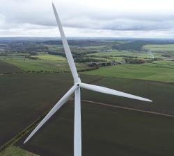
GeoAccess - Aerial Inspections
Price: CALL FOR ASSISTANCE
GeoAccess can offer a stand-alone UAV inspection service and also integrated UAV plus rope-access teams, depending upon the requirements of the inspection. Our flight-crews and rope-access technicians are from similar professional backgrounds, have shared knowledge and experience that allows them to work together seamlessly and efficiently.
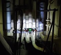
GeoAccess - Interior & Confined Space Aerial Inspections
Price: CALL FOR ASSISTANCE
GeoAccess are always ready to embrace new technology and innovative designs, to that end we have recently acquired a collision-resistant cage for our DJI Phantom 4 Pro by DRONECAGE to enable us to safely conduct inspections in locations that are difficult to access, and certain types of confined spaces.
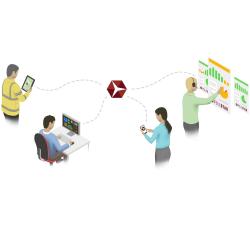
GeoAccess - Asset Management Software
Price: CALL FOR ASSISTANCE
GeoAccess utilises Pole Star Infrastructure Asset Management software in all our operations. Pole Star systems currently provide key solutions to Network Rail, Highways for England, the renewable energy sector, ADIPS (theme park inspections), the petroleum industry and utility companies.
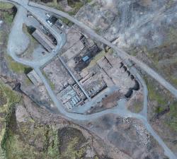
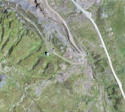
GeoAccess - Mapping & 3D Modelling
Price: CALL FOR ASSISTANCE
Our Principal Pilot has successfully completed a dedicated drone mapping course given by an ex-Royal Air Force aerial imaging and spatial analyst with 25 years of knowledge and experience in this highly specialist field. We can offer 2D mapping (ortho-mosaics) at various levels of resolution, with high relative accuracy and export the finished products in a variety of formats, depending upon client requirements. 3D models can be viewed in Sketch Fab and embedded directly in a webpage.
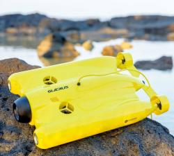
GeoAccess - Underwater Inspections
Price: CALL FOR ASSISTANCE
Once the preserve of traditional remotely operated vehicles (ROVs), GeoAccess can now offer underwater inspections, photography and video with our submersible drone, the Chasing-Innovation Gladius V2. We strongly believe that we can offer a cost-effective, comprehensive underwater inspection service, providing high-resolution photography and 4K video, without compromising quality and safety, and without having to rely on larger, cumbersome, less manoeuvrable ROVs.
GeoAccess - Plant Health & Invasive Species Mapping
Price: CALL FOR ASSISTANCE
Aerial mapping can quickly and efficiently provide a means to assess the health and condition of a wide range of vegetation types and identify invasive species. The maps are a powerful tool for agronomists, farmers, growers and vegetation management teams to locate areas of concern quickly and allow ground-truthing to determine the problems and remedy the situation in much quicker time and make significant cost-savings.