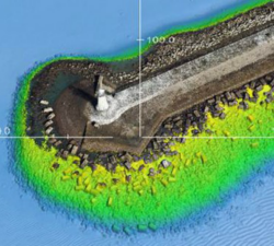
Skeye - Digital Terrain Models
Price: CALL FOR ASSISTANCE
Skeye specializes in making aerial photographs at low altitude with a geometrically calibrated camera. This enables us to obtain all heights, of a landscaped area. At each height (Z) the coordinates (X, Y) are also recorded. This creates a digital terrain model that can be calculated quickly and accurately. The volume of a stockberg can be calculated relative to a base plane or if two measurements take place at different times, a difference calculation can be made.
Skeye - Drone Inspections
Price: CALL FOR ASSISTANCE
Skeye's unmanned aircraft (drones) are able to reach those places that are difficult, expensive, dangerous, 'live' or even impossible for manned inspection teams.
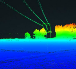
Skeye - UAV LiDAR
Price: CALL FOR ASSISTANCE
Skeye recently added a new sensor for recording geodata in addition to existing sensors such as daylight, near infrared and thermal cameras. The sensor is the YellowScan Surveyor which is capable of making very accurate and dense data points.
Skeye - Aerial Tours
Price: CALL FOR ASSISTANCE
An impressive Skeye product is the 360 degree panoramic tour. Recorded from the sky in combination with additional footage on the ground. This looks like Google Streetview but from the sky.
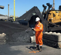
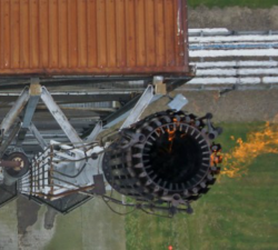
Skeye - Volume Computations
Price: CALL FOR ASSISTANCE
Skeye specializes in the accurate measurement of stocks or mountains stored material using unmanned helicopters (drones). These are equipped with a 36Mp digital camera and geometrically calibrated to perform measurements. These measurements are based on the photogrammetric principle whereby terrain heights can be calculated in the overlapping portion of photographs taken from another point of view.
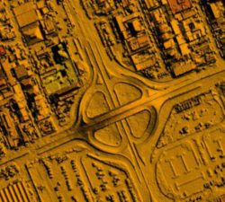
Skeye - Orthophoto Mosaics
Price: CALL FOR ASSISTANCE
Skeye uses unmanned helicopters and aircraft for low-altitude aerial photographs. This enables us to work quickly, flexibly and cost-effective. This low altitude delivers unique and sharp images on which all the details can be seen.
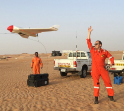
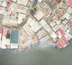
Skeye - Aerial Surveying & Mapping
Price: CALL FOR ASSISTANCE
Skeye uses drones (small unmanned helicopters and aircraft) to make aerial photographs at low altitude. With these pictures we make 3D digital height and terrain models and orthophoto mosaics (underlayers images).
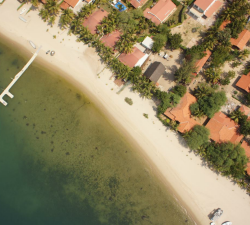
Skeye - Aerial Photography
Price: CALL FOR ASSISTANCE
Skeye BV provides aerial photography throughout the country, both in urban and rural areas. Due to our wide variety of possibilities and materials we can always deliver. We always produce the desired result through the deployment of drones, manned airplanes, helicopters and aerial platforms.