YellowScan - CloudStation - Turn physical projects into digital realities
Price: CALL FOR ASSISTANCE
YellowScan - CloudStation - Turn physical projects into digital realities
Price: CALL FOR ASSISTANCE
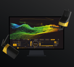
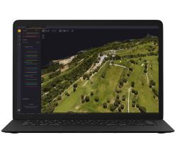
The CloudStation is an evolutive and user-friendly software, developed by YellowScan, to generate and visualize pointclouds.Want to try CloudStation? Take advantage of our 30-day trial!
YellowScan - LiveStation - Real time in-flight monitoring solution
Price: CALL FOR ASSISTANCE
A must for long endurance or complex LiDAR flightsThe YellowScan LiveStation enables you to monitor in real-time the validity and quality of the data being collected by YellowScan LiDAR systems.
Aero Enterprise - Aero-Software Package
Price: CALL FOR ASSISTANCE
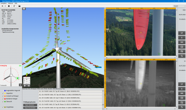
The self-developed AERO-Software Package enables an efficient asset management with AERO-View - for a preview of the results – and AERO-Lyse – for allocation of anomalies, assessment of damages and documentation.
Data-Shack - Analytics Software
Price: CALL FOR ASSISTANCE
ProfessionalProfessionalIdeally used by researchers, data scientists and business analysts.Built-in SmartsBuilt-in SmartsDrag and drop workflow interface to deliver analytic resultsWizard and guided analytics availableSimplified Data Preparation and AggregationSimplified Data Preparation and AggregationAutomatic health check, mashup and aggregationApp Marketplace IntegrationApp Marketplace IntegrationApervitaAlgorithmia
Aero Enterprise - Aero Enterprise Partner Program
Price: CALL FOR ASSISTANCE
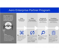
The partner program is based on a division of labor between the co-operation partner and Aero Enterprise. The Partner uses his own conventional DJI drone equipment on site.
YellowScan - Mapper+ - Small & compact. Mighty & powerful
Price: CALL FOR ASSISTANCE
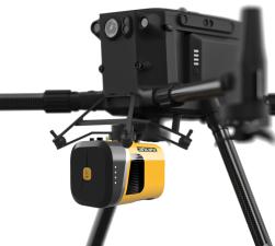
Advanced performance fitted into a compact survey solution. The YellowScan Mapper+ is a lightweight, standalone LiDAR system that integrates the Livox AVIA laser scanner together with a high performance GNSS-aided inertial navigation system. It is the lightest three echoes, high-density, and long-range LiDAR system.
Percepto - The Percepto System
Price: CALL FOR ASSISTANCE
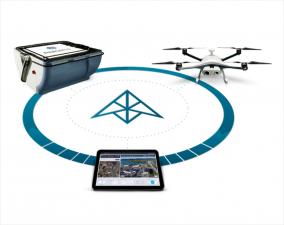
Percepto’s system consists of a weatherproof drone with HD RGB and thermal cameras, a base station for recharging and sheltering the drone and PerceptoCore software suite for flight management, data storage, report management, permissioned team access and computer vision and AI-powered applications. Percepto’s drone systems can be deployed standalone on a site, or as groups of multiple drone-in-a-box systems to meet coverage needs.


