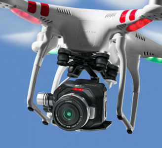
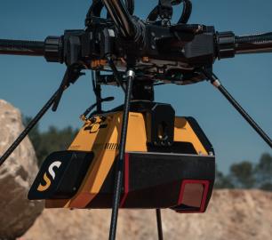
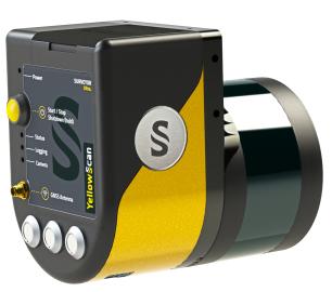
YellowScan - Mapper+ - Small & compact. Mighty & powerful
Advanced performance fitted into a compact survey solution. The YellowScan Mapper+ is a lightweight, standalone LiDAR system that integrates the Livox AVIA laser scanner together with a high performance GNSS-aided inertial navigation system. It is the lightest three echoes, high-density, and long-range LiDAR system.
The Detail
- AGL altitude 100m (330ft)
- System precision 2.5cm (1”)
- System accuracy 3cm (1.2 “)
- Battery weight excl. 1.1kg (2.5lbs)
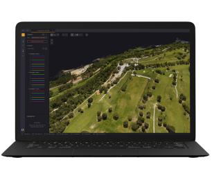
High quality data in any scenarios
Ideally suited for projects requiring higher flight speed. Flight operation speed can go from 5 to 20m/s with a flying height of up to 100m.
Mount it anywhere
The Mapper+ can be mounted on a wide range of UAV platforms due to its low weight.
Be more productive in the field
Choose your power source:
- Skyport/Gremsy for set-up and power through the UAV
- Through the Mapper with its own integrated batteries with 1h30 autonomy
Everything you need in one backpack
Carry your LiDAR along with everything else you might need. This backpack is the size of carry-on luggage and fits in any airline overhead compartment.
You may also like
Microbyte Solutions Ltd
White Label 24/7 IT Helpdesk
CALL FOR PRICE
You can outsource your IT Helpdesk from only £500 a month.Microbyte White Label boosts your suppo
Product DetailYellowScan
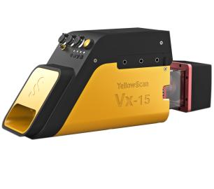
Vx15 - Made for adventurers
CALL FOR ASSISTANCE
Go from mapping inaccessible sites in the Balinese mountains to secluded areas in Chile.
Product Detail
YellowScan
Voyager - Precision meets reality
CALL FOR ASSISTANCE
The YellowScan Voyager is our highest range LiDAR solution with a range of up to 760m (2493 ft.)
Product DetailDRONE TRACKING TECHNOLOGIES
The F-Series VAD drone detection system
CALL FOR ASSISTANCE
The F-Series VAD drone detection system.
Product Detail
Valqari
Valqari Single Locker (DevKit) Drone Delivery Station
CALL FOR ASSISTANCE
The Valqari single locker (DevKit) drone delivery station, enables full autonomous point-to-poi
Product Detail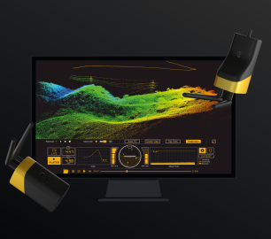
tlmNexus Ltd
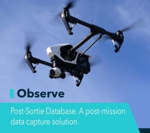
OBSERVE
CALL FOR ASSISTANCE
Tool overview: what will Observe -Post-Sortie Database solve for me?Designed by pilots for pi
Product Detail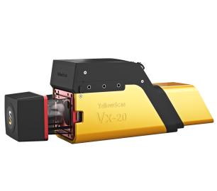
tlmNexus Ltd
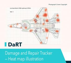
DAMAGE AND REPAIR TRACKER (DaRT)
CALL FOR ASSISTANCE
A popular consultancy and software solutionYour entire system’s damage and repair can be recorde
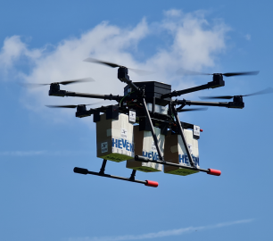
Product DetailHeven Drones
H100
CALL FOR ASSISTANCE
The H100 represents the beginning of Hevens heavy lifter drones.
Product Detail
YellowScan
Surveyor Ultra - New design. Improved results
CALL FOR ASSISTANCE
The new and improved second-generation Surveyor Ultra integrates Hesai’s XT32M2X scanner.
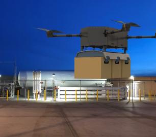
Product DetailHeven Drones
Urban Heven
CALL FOR ASSISTANCE
The Urban Heven is an advanced stage hexacopter drone capable of serving multiple mission types.
Product DetailHeven Drones
H250
CALL FOR ASSISTANCE
The H250 will be the workhorse of Heven’s heavy lifting drones.
Product Detail