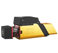
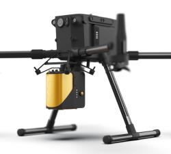
YellowScan - Vx20 - The high-end Vx series made for professionals
Price: CALL FOR ASSISTANCE
The Vx20 series is the ideal solution for high-flight projects with quick data processing needs thanks to the APX20. It is the most accurate system of the Vx series.
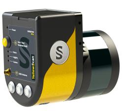
YellowScan - Surveyor Ultra - New design. Improved results
Price: CALL FOR ASSISTANCE
The new and improved second-generation Surveyor Ultra integrates Hesai’s XT32M2X scanner.
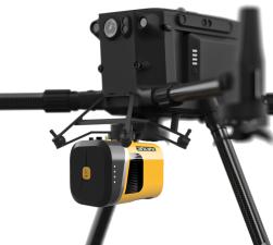
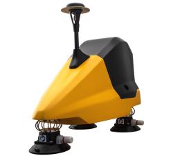
YellowScan - Mapper+ - Small & compact. Mighty & powerful
Price: CALL FOR ASSISTANCE
Advanced performance fitted into a compact survey solution. The YellowScan Mapper+ is a lightweight, standalone LiDAR system that integrates the Livox AVIA laser scanner together with a high performance GNSS-aided inertial navigation system. It is the lightest three echoes, high-density, and long-range LiDAR system.
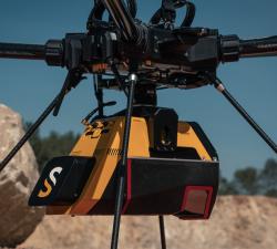
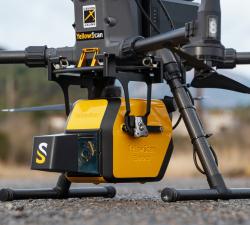
YellowScan - Voyager - Precision meets reality
Price: CALL FOR ASSISTANCE
The YellowScan Voyager is our highest range LiDAR solution with a range of up to 760m (2493 ft.)
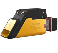
YellowScan - Vx15 - Made for adventurers
Price: CALL FOR ASSISTANCE
Go from mapping inaccessible sites in the Balinese mountains to secluded areas in Chile.
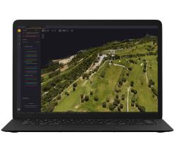
YellowScan - CloudStation - Turn physical projects into digital realities
Price: CALL FOR ASSISTANCE
YellowScan - CloudStation - Turn physical projects into digital realities
Price: CALL FOR ASSISTANCE
The CloudStation is an evolutive and user-friendly software, developed by YellowScan, to generate and visualize pointclouds.Want to try CloudStation? Take advantage of our 30-day trial!
YellowScan - Mapper - Jump into the LiDAR world
Price: CALL FOR ASSISTANCE
Easy mapping redefined Start your LiDAR journey with our easy-to-use Mapper system. Its low weight, mid-range capability, top-end point density and advanced accuracy and precision, make this LiDAR system the best value for money.
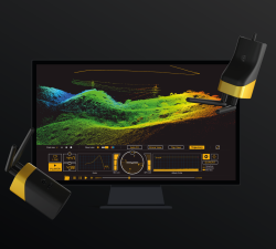
YellowScan - LiveStation - Real time in-flight monitoring solution
Price: CALL FOR ASSISTANCE
A must for long endurance or complex LiDAR flightsThe YellowScan LiveStation enables you to monitor in real-time the validity and quality of the data being collected by YellowScan LiDAR systems.
YellowScan - Fly&Drive - Fly when you can. Drive when you must.
Price: CALL FOR ASSISTANCE
A multi-platform LiDAR for geospatial survey scanning from air to ground.
YellowScan - Explorer: Versatility at its finest
Price: CALL FOR ASSISTANCE
In 2017, YellowScan took part in a research project called FRELON (“French long range lidar”), funded by the European Regional Development Fund. The goal was to develop a new standard for long-range LiDAR by bringing together innovative specialists.