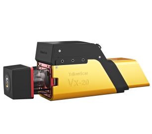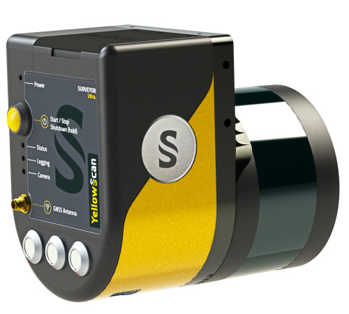
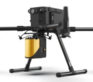
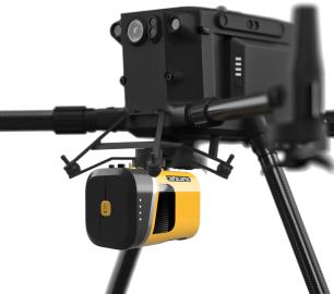
YellowScan - Surveyor Ultra - New design. Improved results
The new and improved second-generation Surveyor Ultra integrates Hesai’s XT32M2X scanner.
The Detail
With the 360° field of view of this laser scanner, the YellowScan Surveyor Ultra answers vertical mapping and mobile mapping needs when combined with Fly & Drive. You can expect better accuracy, precision, intensity, and lighter weight than its predecessor.
- AGL altitude 90m (295ft)
- System precision 3cm (1.2”)
- System accuracy 3cm (1.2“)
- Battery weight excl. 1.32kg (2.92 lbs)
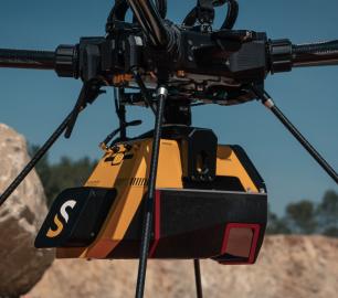
High point density capabilities for high-speed UAV and long-range needs
The Surveyor Ultra is the best option for applications such as vertical inspections (buildings, bridges, coastal erosion, cliffs, mountains).
Easy integration into UAV platforms
This system can be used on multirotor, fixed-wing VTOL and helicopter UAVs. This flexibility is an asset if you have a great diversity of missions: sizes and reliefs. Fixed-wing VTOL for big areas to survey, multirotor for small areas or vertical sections.
360° field of view: vertical mapping-ready
The Surveyor Ultra allows for the collection of LiDAR data not only from the ground, but for verticals as well.
Turn-key, simple to operate & self-powered
As with all YellowScan LiDAR systems, the Surveyor Ultra follows the “Just Press the Yellow Button” philosophy. It is designed for 3D modeling under vegetation and fast data processing.
Fly when you can. Drive when you must.
The Surveyor Ultra is suitable for mobile mapping with the YellowScan Fly&Drive. It comes with:
- A 4-kg car pod for mobile mapping with 3 built-in suction cups, a wire rope vibration isolator system, a GNSS antenna, and a roof bar
- A wheel-mounted odometer, measuring the distance driven to improve final trajectory data
- Specific dual use dynamic model for mobile/UAV mapping
- External power supply with a cable connected to the car cigarette lighter socket
- The LiveStation software for live visualization.
No need to get out of the vehicle to start the acquisition as it can be done through the LiveStation
You may also like
tlmNexus Ltd
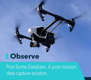
OBSERVE
CALL FOR ASSISTANCE
Tool overview: what will Observe -Post-Sortie Database solve for me?Designed by pilots for pi
Product Detail
Teal Consulting

Operational Excellence
CALL FOR ASSISTANCE
Teal Consulting - Operational ExcellenceOperational excellence is crucial to businesses achieving
Product Detail
tlmNexus Ltd
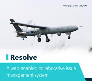
RESOLVE
CALL FOR ASSISTANCE
Tool overview: what will Resolve solve for me?Equipment issues that affect airworthiness, saf
Product DetailHeven Drones
H100
CALL FOR ASSISTANCE
The H100 represents the beginning of Hevens heavy lifter drones.
Product DetailDRONE TRACKING TECHNOLOGIES
The P-Series VAD drone detection system
CALL FOR ASSISTANCE
The P-Series VAD drone detection system
Product DetailtlmNexus Ltd
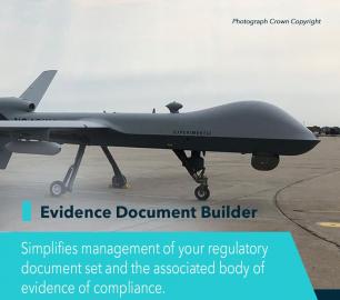
EVIDENCE DOCUMENT BUILDER
CALL FOR ASSISTANCE
Tool overview: what will Evidence Document Builder (EDB) solve for me? Complying with t
Product DetailYellowScan
Mapper - Jump into the LiDAR world
CALL FOR ASSISTANCE
Easy mapping redefined Start your LiDAR journey with our easy-to-use Mapper system. Its low weight
Product DetailTeal Consulting

Developing Collaborative Business Relationships
CALL FOR ASSISTANCE
Developing Collaborative Business Relationships - ISO 44001Organisations have long recognised tha
Product Detail
YellowScan
Fly&Drive - Fly when you can. Drive when you must.
CALL FOR ASSISTANCE
A multi-platform LiDAR for geospatial survey scanning from air to ground.
Product DetailMicrobyte Solutions Ltd

Telecoms
CALL FOR ASSISTANCE
Complete telecoms for a fixed monthly feeWhen it comes to business grade telephone solutions,
Product Detail