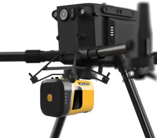
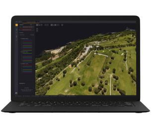
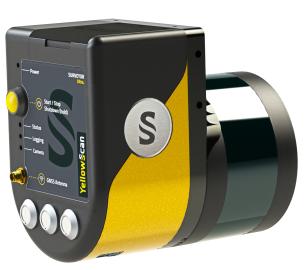
YellowScan - Mapper - Jump into the LiDAR world
Easy mapping redefined
Start your LiDAR journey with our easy-to-use Mapper system. Its low weight, mid-range capability, top-end point density and advanced accuracy and precision, make this LiDAR system the best value for money.
The Detail
- AGL altitude 70m (230ft)
- System precision 2cm (0.8”)
- System accuracy 3cm (1.2“)
- Battery weight excl. 1.5kg (3.31 lbs)
Be more productive in the field
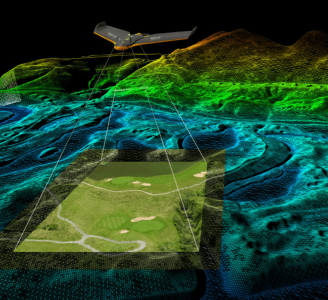
For optimized productivity, we recommend a balanced 10 m/s flight speed to benefit for optimal point density. Map 10 hectares in 3 minutes flying at 70m AGL, 10 m/s, with 20% sidelap.
Designed to fit any UAVs
Easily mount it on a variety of UAVs: multirotor, fixed-wing or helicopter drones.
The Gremsy and DJI skyport integrations, or our custom-made mounting bracket allows for a swift set-up to get mapping quickly.
You've got the power-
Choose your power source: -
- Skyport/Gremsy for set-up and power through the UAV
- Through the Mapper with its own integrated batteries with 1h30 autonomy
Withstand external conditions/ events
Rain is not an issue during data collection, thanks to the Mapper’s IPW55 protection.
Everything you need in one backpack
Carry your LiDAR along with everything else you might need. This backpack is the size of carry-on luggage and fits in any airline overhead compartment.
You may also like
DRONE TRACKING TECHNOLOGIES
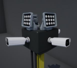
The F-Series VAD drone detection system
CALL FOR ASSISTANCE
The F-Series VAD drone detection system.
Product DetailYellowScan
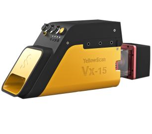
Vx15 - Made for adventurers
CALL FOR ASSISTANCE
Go from mapping inaccessible sites in the Balinese mountains to secluded areas in Chile.
Product Detail
Heven Drones
Urban Heven
CALL FOR ASSISTANCE
The Urban Heven is an advanced stage hexacopter drone capable of serving multiple mission types.
Product DetailYellowScan
Voyager - Precision meets reality
CALL FOR ASSISTANCE
The YellowScan Voyager is our highest range LiDAR solution with a range of up to 760m (2493 ft.)
Product DetailDRONE TRACKING TECHNOLOGIES
The P-Series VAD drone detection system
CALL FOR ASSISTANCE
The P-Series VAD drone detection system
Product DetailYellowScan
Surveyor Ultra - New design. Improved results
CALL FOR ASSISTANCE
The new and improved second-generation Surveyor Ultra integrates Hesai’s XT32M2X scanner.
Product Detail
tlmNexus Ltd
EVIDENCE DOCUMENT BUILDER
CALL FOR ASSISTANCE
Tool overview: what will Evidence Document Builder (EDB) solve for me? Complying with t
Product DetailALTI
Reach - VTOL UAV
CALL FOR ASSISTANCE
The ALTI Reach is the upcoming 'bigger brother' to the ALTI Transition.
Product DetailTeal Consulting

Developing Collaborative Business Relationships
CALL FOR ASSISTANCE
Developing Collaborative Business Relationships - ISO 44001Organisations have long recognised tha
Product DetailtlmNexus Ltd
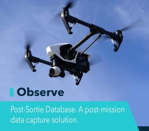
OBSERVE
CALL FOR ASSISTANCE
Tool overview: what will Observe -Post-Sortie Database solve for me?Designed by pilots for pi
Product DetailValqari
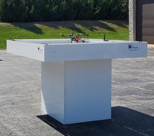
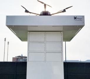
Valqari Single Locker (DevKit) Drone Delivery Station
CALL FOR ASSISTANCE
The Valqari single locker (DevKit) drone delivery station, enables full autonomous point-to-poi
Product Detail