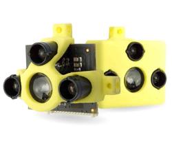
Terabee - TeraRanger One
Price: CALL FOR PRICE
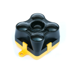
A small, lightweight & high-performance single-point distance measurement sensor using infrared LED Time-of-Flight technology for indoor and outdoor conditions. The lightweight design (only 8g), high performance (up to 1000 readings per second), low power consumption and stable datastream make it perfect for reliable altitude control, precision landing, terrain following and anti-collision, both indoors and outdoors.
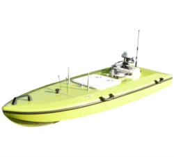
AiDrones - AxBoat
Price: CALL FOR ASSISTANCE
The AxBoat is an autonomous, versatile and highly maneuverable survey vehicle equipped with innovative ultrasonic sound sensor technology for mapping and surveying of rivers, lakes, harbors and shallow ocean bottoms.
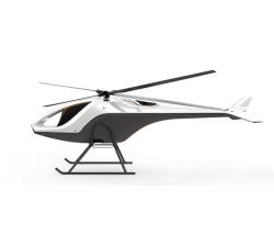
AiDrones - AiD-H85
Price: CALL FOR ASSISTANCE
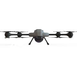
The AiD-H85 is a versatile RPAS (Remotely Piloted Aerial System) helicopter featuring an intermeshing double rotor design that does not require a tail rotor. This leads to an outstanding stability, reliability and an extraordinary lift capacity of 50 kg.
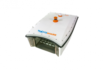
RanMarine Technology BV - Wasteshark
Price: CALL FOR ASSISTANCE
WasteShark® is a drone (an unmanned autonomous vehicle) designed for urban, inland and near-coastal waters. The WasteShark is designed to act as buoyant and mobile waste clearing and environmental data collection. Depending on configuration, Plastics and micro-plastic (to 3mm), general trash, oils and chemical pollutants, invasive surface plants and species (e.g. jellyfish).
Terabee - TeraRanger Evo 60m
Price: CALL FOR PRICE
TeraRanger Evo is the long range distance sensor of the TeraRanger family and is ideal for reliable altitude control, terrain following and anti-collision, both indoors and outdoors. Using LED Time-of-Flight technology (rather than lasers) the 9-gram distance sensor can measure distances up to a 60-meter range! In addition to its long-range capability, it has a modular two-part design, supporting a wide range of power, communication and connector options without additional cables.
FLY-R UAS - R2-240
Price: CALL FOR ASSISTANCE
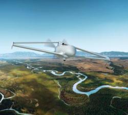
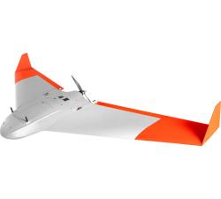
The R2-240 was specially designed for extended range ISR operations. Like all aircraft of the R2 family it has the rhomboidal Wing aerodynamic configuration, which is a unique know how of FLY-R.The R2-240 is equipped with a Series Hybrid Propulsion and Power Generation system which allows long endurance missions with heavy payloads.Like the R2-150, the aircraft is fully autonomous and can be deployed from Land or Ship using the FLY-R Launcher and Automatic Recovery Systems.
AiDrones - AiD-MC8
Price: CALL FOR ASSISTANCE
The AiDrones AiD-MC8 unmanned aerial vehicle is an exclusively commercial project aimed primarily at civilian applications. In fact, the drone AiDrones AiD-MC8 is positioned as an industrial unmanned aerial vehicle. However, due to the rather wide scope of this device, it can be used for aerial photography and aerial photography, used for monitoring the environmental situation, applied for cartography and topography, For geological and geodetic exploration, etc.
Sky-Watch - Cumulus
Price: CALL FOR ASSISTANCE
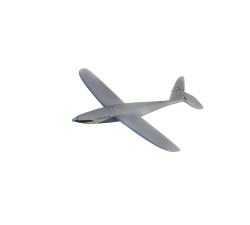
Cumulus is an extremely easy-to-use and highly autonomous fixed wing drone built in first class materials for precision agricultural, mapping and surveying. The aircraft is made from the best carbon fiber and kevlar, which makes it one of the most robust UAVs on the market.
Aero Enterprise - Aero-Software Package
Price: CALL FOR ASSISTANCE
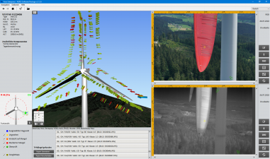
The self-developed AERO-Software Package enables an efficient asset management with AERO-View - for a preview of the results – and AERO-Lyse – for allocation of anomalies, assessment of damages and documentation.
AiDrones - Sonoboat
Price: CALL FOR ASSISTANCE
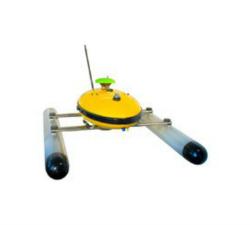
The Sonoboat is a cartographic surveying vehicle, capable of autonomous and remotely controlled operation. It is ideal for missions in hard to reach or dangerous locations. The ease of deployment and compact size significantly reduce the costs of waterbody mapping and similar applications.
Terabee - TeraRanger Tower
Price: CALL FOR PRICE
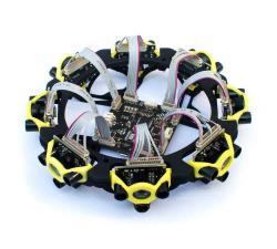
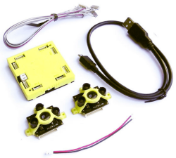
With zero moving parts, TeraRanger Tower is a silent & reliable alternative to rotating LiDAR scanners for navigation and obstacle avoidance. It combines 8 TeraRanger One sensors in a circular array and the TeraRanger Hub to create a lightweight, fast (up to 270 Hz), and eye-safe scanner. Calibrated distance data is streamed from a USB or UART port as an array of synchronized distances, in millimetres.
Terabee - TeraRanger Multiflex
Price: CALL FOR PRICE
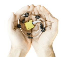
TeraRanger Multiflex is the modular & low-cost solution for simple obstacle avoidance on drones, indoors up to 2-meter range! It’s the ideal –and higher performance – alternative to ultrasound all in one convenient and easy to use kit. Each Multiflex kit includes up to eight plug-and-play sensor modules that can be connected to a flexible bus.
Terabee - TeraRanger Hub Kit
Price: CALL FOR PRICE
The TeraRanger Hub kit is an obstacle avoidance sensor and makes it easy to connect multiple TerRanger sensors to a single power and data hub and to integrate the data stream to your control platform. This is great for times when you want sensors simultaneously monitoring multiple axes.The kit enables you to plug and play with up to eight distance sensors and obtain high-speed distance data from each sensor.
AeroTerrascan - Ai450-ER
Price: CALL FOR ASSISTANCE
Unmanned aircraft systems (UAVs) Ai450 series is a flagship model by AeroTerrascan which is a popular solution among palm oil plantations in Indonesia to meet the needs of survey applications and air mapping. Variant Ai450-ER is the latest evolution of the Ai450 series which has better flying performance than previous variants.
Chronos Technology - GPS/GLONASS - CTL3510 JAMMER DETECTOR
Price: CALL FOR ASSISTANCE
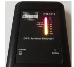
Concerned about your drone being jammed?Chronos’s CTL3510 GNSS Interference Detector with Event Logging is a handheld device designed to detect and quickly locate the presence of jamming signals from commercially available GPS jammers or too much power or interference in the GPS (L1) or Galileo (E1) bands.


