Terabee - TeraRanger Tower
Price: CALL FOR PRICE
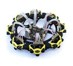
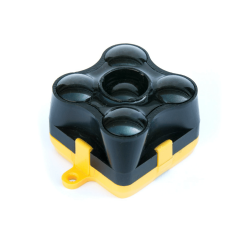
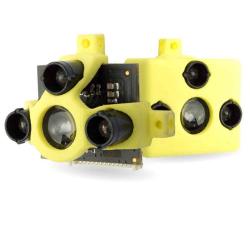
With zero moving parts, TeraRanger Tower is a silent & reliable alternative to rotating LiDAR scanners for navigation and obstacle avoidance. It combines 8 TeraRanger One sensors in a circular array and the TeraRanger Hub to create a lightweight, fast (up to 270 Hz), and eye-safe scanner. Calibrated distance data is streamed from a USB or UART port as an array of synchronized distances, in millimetres.
Ukrspecsystems - PC-1
Price: CALL FOR ASSISTANCE
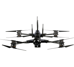
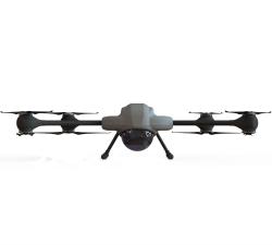
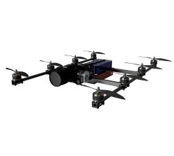
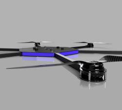
Our PC-1 VTOL drone features extremely durable airframe made of carbon fiber. Its eight rotors design offer maximum reliability in any wether conditions and environment. No matter when or where you will use our drone it will always do the job.
AiDrones - AiD-H85
Price: CALL FOR ASSISTANCE
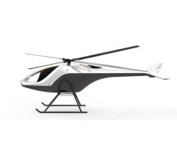
The AiD-H85 is a versatile RPAS (Remotely Piloted Aerial System) helicopter featuring an intermeshing double rotor design that does not require a tail rotor. This leads to an outstanding stability, reliability and an extraordinary lift capacity of 50 kg.
Terabee - TeraRanger Multiflex
Price: CALL FOR PRICE
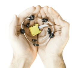
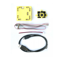
TeraRanger Multiflex is the modular & low-cost solution for simple obstacle avoidance on drones, indoors up to 2-meter range! It’s the ideal –and higher performance – alternative to ultrasound all in one convenient and easy to use kit. Each Multiflex kit includes up to eight plug-and-play sensor modules that can be connected to a flexible bus.
Chronos Technology - GPS/GLONASS - CTL3520 Handheld GPS Jammer Detector and Locator
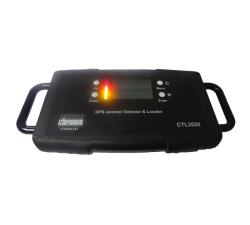
Price: CALL FOR ASSISTANCE
Chronos Technology - GPS/GLONASS - CTL3520 Handheld GPS Jammer Detector and Locator
Price: CALL FOR ASSISTANCE
Concerned about your drone being jammed?The Chronos CTL3520 GPS Jammer Detector and Locator is ideal for the detection and location of commercially available GPS jammers. This handheld, battery operated device is designed to detect and quickly locate the presence of jamming signals from commercially available GPS jammers or too much power or interference broadcast in the GPS (L1) band.
Aero Enterprise - Aero Enterprise Partner Program
Price: CALL FOR ASSISTANCE
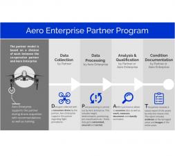
The partner program is based on a division of labor between the co-operation partner and Aero Enterprise. The Partner uses his own conventional DJI drone equipment on site.
AiDrones - AxBoat
Price: CALL FOR ASSISTANCE
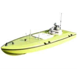
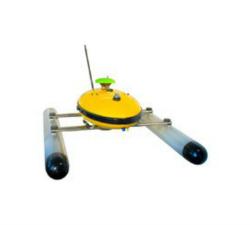
The AxBoat is an autonomous, versatile and highly maneuverable survey vehicle equipped with innovative ultrasonic sound sensor technology for mapping and surveying of rivers, lakes, harbors and shallow ocean bottoms.
Evolve Dynamics - Sky Mantis UAS
Price: CALL FOR ASSISTANCE
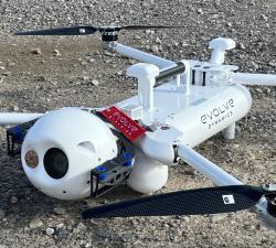
The Sky Mantis is an extremely capable UAS that has operated in the Temperate, Arctic and desert environments, in high winds and rain, both at sea and on land. It has been designed to support the defence sector, emergency services, search and rescue and other government agencies.
Terabee - TeraRanger Evo 60m
Price: CALL FOR PRICE
TeraRanger Evo is the long range distance sensor of the TeraRanger family and is ideal for reliable altitude control, terrain following and anti-collision, both indoors and outdoors. Using LED Time-of-Flight technology (rather than lasers) the 9-gram distance sensor can measure distances up to a 60-meter range! In addition to its long-range capability, it has a modular two-part design, supporting a wide range of power, communication and connector options without additional cables.
Terabee - TeraRanger Hub Kit
Price: CALL FOR PRICE
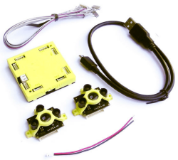
The TeraRanger Hub kit is an obstacle avoidance sensor and makes it easy to connect multiple TerRanger sensors to a single power and data hub and to integrate the data stream to your control platform. This is great for times when you want sensors simultaneously monitoring multiple axes.The kit enables you to plug and play with up to eight distance sensors and obtain high-speed distance data from each sensor.
Accipiter - Accipiter®BVLOS Surveillance System (BSS)
Price: CALL FOR ASSISTANCE
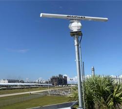
AN ACCIPITER® is an essential part of any BVLOS unmanned aircraft system (UAS) Whether you are carrying out inspection or delivery missions by flying a single drone over a short distance, or whether you are operating a fleet of drones over a wide area spanning thousands of square miles, a county or a state, there is an Accipiter® BVLOS Surveillance System (BSS) that is right sized for you.
Terabee - Inspection Drone Kit
Price: CALL FOR PRICE
The TeraRanger Inspection Drone Kit is used for drone pilot aid and utilizes the small, lightweight (8g) and high-performance TeraRanger One distance sensor/s (8g) and a small electronics board to interface to the live analogue video feed. Drone pilots benefit from fast distance-to-target data being streamed to their live video feed to assist with complex flights in close proximity to potential obstacles and hazards.
AiDrones - AiD-MC8
Price: CALL FOR ASSISTANCE
The AiDrones AiD-MC8 unmanned aerial vehicle is an exclusively commercial project aimed primarily at civilian applications. In fact, the drone AiDrones AiD-MC8 is positioned as an industrial unmanned aerial vehicle. However, due to the rather wide scope of this device, it can be used for aerial photography and aerial photography, used for monitoring the environmental situation, applied for cartography and topography, For geological and geodetic exploration, etc.
Air Control Entech - Visual Inspection UAV
Price: CALL FOR ASSISTANCE
Our Livestream Visual Inspection UAV is our signature Visual Inspection technology, incorporating a real-time data link from UAV to onshore personnel for in-situ visualisation of the asset. Data is compressed and transferred via VSAT, enabling high-resolution live stream over a low-bandwidth connection. Data transfer via 4G networks is in development.
Percepto - The Percepto System
Price: CALL FOR ASSISTANCE
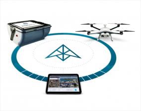
Percepto’s system consists of a weatherproof drone with HD RGB and thermal cameras, a base station for recharging and sheltering the drone and PerceptoCore software suite for flight management, data storage, report management, permissioned team access and computer vision and AI-powered applications. Percepto’s drone systems can be deployed standalone on a site, or as groups of multiple drone-in-a-box systems to meet coverage needs.
GeoAccess - Asset Management Software
Price: CALL FOR ASSISTANCE
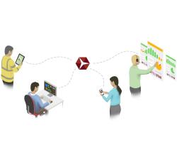
GeoAccess utilises Pole Star Infrastructure Asset Management software in all our operations. Pole Star systems currently provide key solutions to Network Rail, Highways for England, the renewable energy sector, ADIPS (theme park inspections), the petroleum industry and utility companies.
Air Control Entech - Ultrasonic Inspection UAV
Price: CALL FOR ASSISTANCE
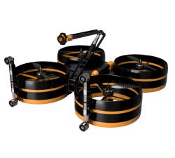
Our Ultrasonic Inspection UAV is engineered to produce repeatable readings. Powerful electromagnets enable the UAV to attach and lock on to infrastructure, stabilising the platform and ensuring the capture of accurate UT readings. Reduced power consumption allows for an extended utilisation of up to 6 hours.
Aero Enterprise - Aero-Software Package
Price: CALL FOR ASSISTANCE
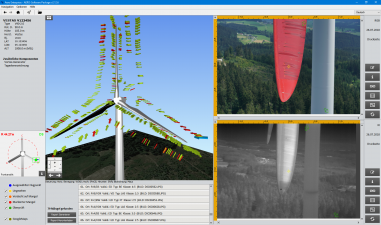
The self-developed AERO-Software Package enables an efficient asset management with AERO-View - for a preview of the results – and AERO-Lyse – for allocation of anomalies, assessment of damages and documentation.
Terabee - TeraRanger One
Price: CALL FOR PRICE
A small, lightweight & high-performance single-point distance measurement sensor using infrared LED Time-of-Flight technology for indoor and outdoor conditions. The lightweight design (only 8g), high performance (up to 1000 readings per second), low power consumption and stable datastream make it perfect for reliable altitude control, precision landing, terrain following and anti-collision, both indoors and outdoors.
AiDrones - Sonoboat
Price: CALL FOR ASSISTANCE
The Sonoboat is a cartographic surveying vehicle, capable of autonomous and remotely controlled operation. It is ideal for missions in hard to reach or dangerous locations. The ease of deployment and compact size significantly reduce the costs of waterbody mapping and similar applications.
Air Control Entech - 3D Laser Scanning UAV
Price: CALL FOR ASSISTANCE
Our 3D Laser Scanning UAV is designed for precision, using a multi-purpose platform which has been specifically engineered to carry a FARO freestyle X Laser Scanner. Data integration with a ground scanner allows for Sub-3mm accuracy, enabling detailed re-engineering models to be created.


