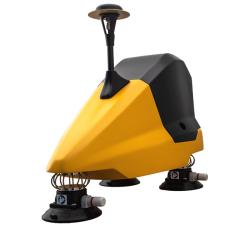
AiDrones - Sonoboat
Price: CALL FOR ASSISTANCE
The Sonoboat is a cartographic surveying vehicle, capable of autonomous and remotely controlled operation. It is ideal for missions in hard to reach or dangerous locations. The ease of deployment and compact size significantly reduce the costs of waterbody mapping and similar applications.
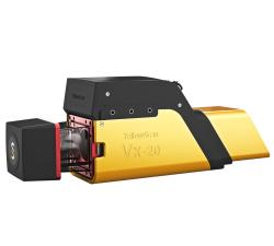
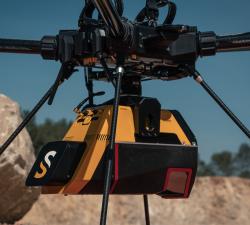
YellowScan - Vx20 - The high-end Vx series made for professionals
Price: CALL FOR ASSISTANCE
The Vx20 series is the ideal solution for high-flight projects with quick data processing needs thanks to the APX20. It is the most accurate system of the Vx series.
YellowScan - Fly&Drive - Fly when you can. Drive when you must.
Price: CALL FOR ASSISTANCE
A multi-platform LiDAR for geospatial survey scanning from air to ground.
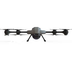
AiDrones - AiD-MC8
Price: CALL FOR ASSISTANCE
The AiDrones AiD-MC8 unmanned aerial vehicle is an exclusively commercial project aimed primarily at civilian applications. In fact, the drone AiDrones AiD-MC8 is positioned as an industrial unmanned aerial vehicle. However, due to the rather wide scope of this device, it can be used for aerial photography and aerial photography, used for monitoring the environmental situation, applied for cartography and topography, For geological and geodetic exploration, etc.
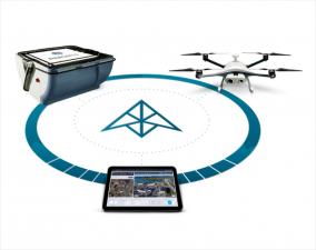
Percepto - The Percepto System
Price: CALL FOR ASSISTANCE
Percepto’s system consists of a weatherproof drone with HD RGB and thermal cameras, a base station for recharging and sheltering the drone and PerceptoCore software suite for flight management, data storage, report management, permissioned team access and computer vision and AI-powered applications. Percepto’s drone systems can be deployed standalone on a site, or as groups of multiple drone-in-a-box systems to meet coverage needs.
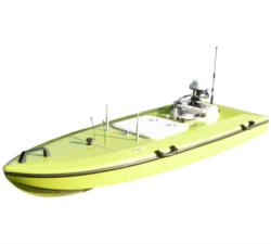
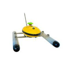
AiDrones - AxBoat
Price: CALL FOR ASSISTANCE
The AxBoat is an autonomous, versatile and highly maneuverable survey vehicle equipped with innovative ultrasonic sound sensor technology for mapping and surveying of rivers, lakes, harbors and shallow ocean bottoms.
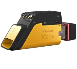
YellowScan - Vx15 - Made for adventurers
Price: CALL FOR ASSISTANCE
Go from mapping inaccessible sites in the Balinese mountains to secluded areas in Chile.
YellowScan - Voyager - Precision meets reality
Price: CALL FOR ASSISTANCE
The YellowScan Voyager is our highest range LiDAR solution with a range of up to 760m (2493 ft.)
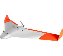
AeroTerrascan - Ai450-ER
Price: CALL FOR ASSISTANCE
Unmanned aircraft systems (UAVs) Ai450 series is a flagship model by AeroTerrascan which is a popular solution among palm oil plantations in Indonesia to meet the needs of survey applications and air mapping. Variant Ai450-ER is the latest evolution of the Ai450 series which has better flying performance than previous variants.
YellowScan - Mapper - Jump into the LiDAR world
Price: CALL FOR ASSISTANCE
Easy mapping redefined Start your LiDAR journey with our easy-to-use Mapper system. Its low weight, mid-range capability, top-end point density and advanced accuracy and precision, make this LiDAR system the best value for money.
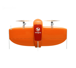
Wingtra - WingtraOne
Price: CALL FOR ASSISTANCE
Meet the WingtraOne: a professional drone that simplifies mapping and surveying through easy and smart aerial data collection.
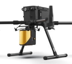
AiDrones - AiD-H85
Price: CALL FOR ASSISTANCE
The AiD-H85 is a versatile RPAS (Remotely Piloted Aerial System) helicopter featuring an intermeshing double rotor design that does not require a tail rotor. This leads to an outstanding stability, reliability and an extraordinary lift capacity of 50 kg.