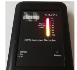
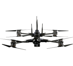
Chronos Technology - GPS/GLONASS - CTL3510 JAMMER DETECTOR
Price: CALL FOR ASSISTANCE
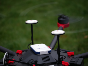
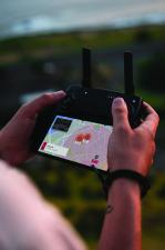
Concerned about your drone being jammed?Chronos’s CTL3510 GNSS Interference Detector with Event Logging is a handheld device designed to detect and quickly locate the presence of jamming signals from commercially available GPS jammers or too much power or interference in the GPS (L1) or Galileo (E1) bands.
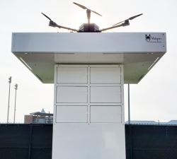
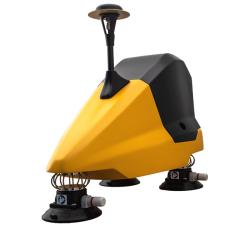
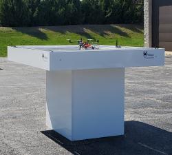
Valqari - 6 Locker Drone Delivery Station
Price: CALL FOR ASSISTANCE
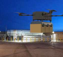
The Valqari, 6 locker drone delivery station, enables fully autonomous, point-to-point delivery. It can accept packages delivered via precision landing, hover drops, winches, or traditional ground delivery. The locker station facilitates more accurate route planning & flight scheduling and is capable of integration with most drones.
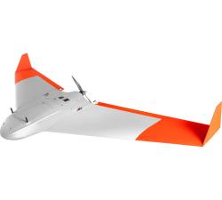
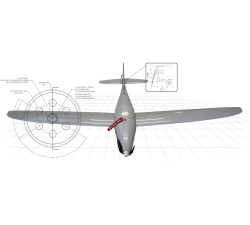
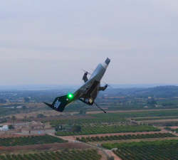
FLY-R UAS - R2-150
Price: CALL FOR ASSISTANCE
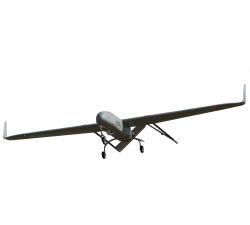
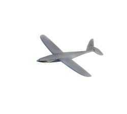
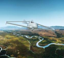
The R2-150 is the smaller aircraft of the R2 family. It is a fully autonomous aircraft with an electrical propulsion system and is specially designed for surveillance missions.It can be deployed and operated from land or from the deck of a ship while in navigation. It is launched with a catapult and can autonomously land on an unprepared ground or be autonomously recovered in a recovery net.Launcher and recovery systems are also FLY-R products. Its simplicity of use and maintenance free operation make the R2-150 a very cost- effective operational system.
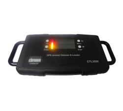
Chronos Technology - GPS/GLONASS - CTL3520 Handheld GPS Jammer Detector and Locator
Price: CALL FOR ASSISTANCE
Chronos Technology - GPS/GLONASS - CTL3520 Handheld GPS Jammer Detector and Locator
Price: CALL FOR ASSISTANCE
Concerned about your drone being jammed?The Chronos CTL3520 GPS Jammer Detector and Locator is ideal for the detection and location of commercially available GPS jammers. This handheld, battery operated device is designed to detect and quickly locate the presence of jamming signals from commercially available GPS jammers or too much power or interference broadcast in the GPS (L1) band.
AeroTerrascan - Ai450-ER
Price: CALL FOR ASSISTANCE
Unmanned aircraft systems (UAVs) Ai450 series is a flagship model by AeroTerrascan which is a popular solution among palm oil plantations in Indonesia to meet the needs of survey applications and air mapping. Variant Ai450-ER is the latest evolution of the Ai450 series which has better flying performance than previous variants.
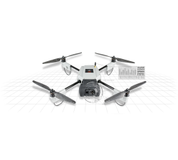
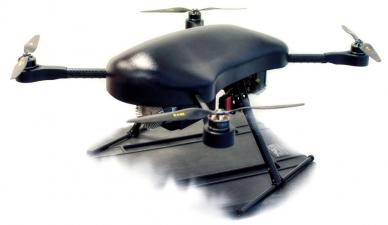
Sky-Watch - Huginn X1D
Price: CALL FOR ASSISTANCE
Huginn X1D is a quadcopter system. The setup enables it to perform vertical take-off and landings without any launching or landing mechanisms. The intuitive and logical user interface facilitates personnel with little or no technical knowledge to operate the Huginn X1D following only a minimum of training. With a deployment time of less than one minute, the Huginn X1D is the perfect tool for reaching inaccessible or high-risk areas. The advanced avionics in the Huginn X1D have been designed w
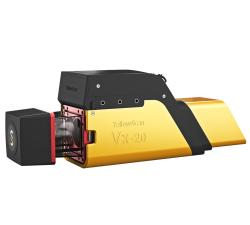
YellowScan - Vx20 - The high-end Vx series made for professionals
Price: CALL FOR ASSISTANCE
The Vx20 series is the ideal solution for high-flight projects with quick data processing needs thanks to the APX20. It is the most accurate system of the Vx series.
Sky-Watch - Heidrun V1
Price: CALL FOR ASSISTANCE
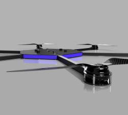
Heidrun V1 is a portable, lightweight highly autonomous Unmanned Aerial Vehicle (UAV) designed for Defense and Law Enforcement. The drone is made of first class carbon fiber, which makes it one of the most robust UAV on the market.
UAV Works - VALAQ Patrol 120
Price: From £33,000 - £36,000
VALAQ Patrol is a solid surveillance tool to give aerial coverage to multiusers. Can be deploy in just 2 minutes, with VTOL feature, weights just 4.2 kg, with 60 minutes and an endurance of 70 km - 34 mi range. Camera Colibri2 (40x and IR) or visual 80x can be ordered. It can chase autonomously a hidden beacon, and share camera images to any interest user. Ideal for Police, or private security companies.
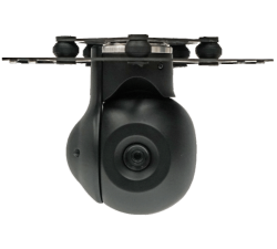
Ukrspecsystems - USG-251
Price: CALL FOR ASSISTANCE
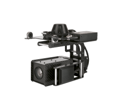
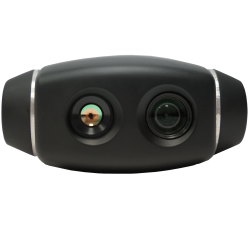
Meet our micro gimbal with 2-axis gyro-stabilization. USG-251 features Full HD day-view camera with 10x optical zoom. In addition, this gimbal features optical video stabilization. Ultra-low weight - only 350g. Designed for multirotor and fixed-wing UAV platforms.
Fossils Stuff - FSGX 210
Price: CALL FOR ASSISTANCE
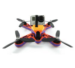
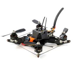
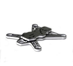
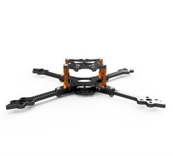
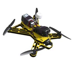
A true X frame for 5″ props. The FSGX 210 Racing Frame has been CNC machined to the highest tolerances from three pieces of HDPE. This frame must be one of the toughest racing frames on the market and comes with an optional Limited Lifetime Frame Warranty.
Unifly - Unifly BLIP
Price: CALL FOR ASSISTANCE
Drone tracking and e-Identification Unifly has developed a drone tracking and e-Identification product: the Unifly BLIP. This stands for Broadcast Location & Identification Platform. BLIP is tailored to the specific needs of UTM service providers, local authorities and drone operators.
Ukrspecsystems - PD-1
Price: CALL FOR ASSISTANCE
PD-1 Unmanned Aerial System is ready to fly solution that comes standard equipped with gas-powered fixed-wing UAV, EO/IR camera system, data links and ground control station and now a VTOL module which gives you even more freedom in your missions. PD-1 can stay in the air for up to 10 hours with 8 kg payload and well-suited for surveillance, aerial photography, agriculture, search and rescue and public safety applications.
Terabee - TeraRanger One
Price: CALL FOR PRICE
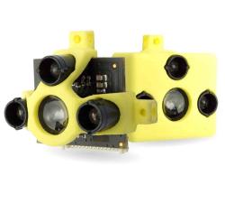
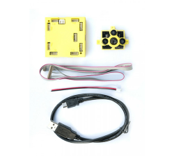
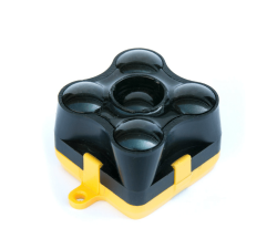
A small, lightweight & high-performance single-point distance measurement sensor using infrared LED Time-of-Flight technology for indoor and outdoor conditions. The lightweight design (only 8g), high performance (up to 1000 readings per second), low power consumption and stable datastream make it perfect for reliable altitude control, precision landing, terrain following and anti-collision, both indoors and outdoors.
AiDrones - AxBoat
Price: CALL FOR ASSISTANCE
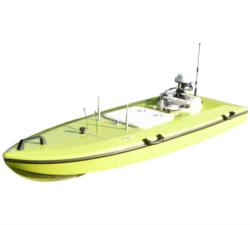
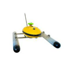
The AxBoat is an autonomous, versatile and highly maneuverable survey vehicle equipped with innovative ultrasonic sound sensor technology for mapping and surveying of rivers, lakes, harbors and shallow ocean bottoms.
Wingtra - WingtraOne
Price: CALL FOR ASSISTANCE
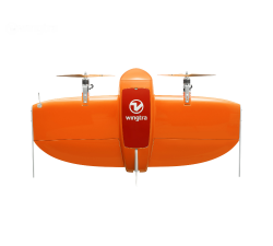
Meet the WingtraOne: a professional drone that simplifies mapping and surveying through easy and smart aerial data collection.
Ukrspecsystems - USG-211
Price: CALL FOR ASSISTANCE
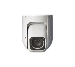
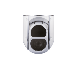
USG-211 is a compact and affordable camera system for unmanned aerial vehicles. It can be equipped either with Full HD day-view camera with 30x optical zoom or thermal camera with digital zoom. The USG-211 weighs only 900g.
Fossils Stuff - Revo
Price: CALL FOR ASSISTANCE
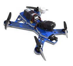
The Revo series of carbon fibre FPV racing frames uses a revolutionary rigging system made from state of the art dyneema cord to stiffen the frame arms.
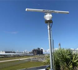
Accipiter - Accipiter®BVLOS Surveillance System (BSS)
Price: CALL FOR ASSISTANCE
AN ACCIPITER® is an essential part of any BVLOS unmanned aircraft system (UAS) Whether you are carrying out inspection or delivery missions by flying a single drone over a short distance, or whether you are operating a fleet of drones over a wide area spanning thousands of square miles, a county or a state, there is an Accipiter® BVLOS Surveillance System (BSS) that is right sized for you.
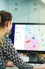
Unifly - Unifly Supervisor portal
Price: CALL FOR ASSISTANCE
The Unifly database contains all the data needed by authorities to visualize and manage the airspace and unmanned traffic.
Terabee - TeraRanger Multiflex
Price: CALL FOR PRICE
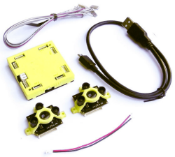
TeraRanger Multiflex is the modular & low-cost solution for simple obstacle avoidance on drones, indoors up to 2-meter range! It’s the ideal –and higher performance – alternative to ultrasound all in one convenient and easy to use kit. Each Multiflex kit includes up to eight plug-and-play sensor modules that can be connected to a flexible bus.
Paua - Paua Technology
Price: CALL FOR ASSISTANCE
Paua is constantly developing and co-developing innovative protective products across numerous markets. Our professional designers and sample production partner facilities work together with you to allow you to realise your products quickly and efficiently.
GeoAccess - Asset Management Software
Price: CALL FOR ASSISTANCE
GeoAccess utilises Pole Star Infrastructure Asset Management software in all our operations. Pole Star systems currently provide key solutions to Network Rail, Highways for England, the renewable energy sector, ADIPS (theme park inspections), the petroleum industry and utility companies.
Unifly - Unifly User Tools (UTM)
Price: CALL FOR ASSISTANCE
Unifly’s Unmanned Traffic Management (UTM) platform connects official entities with operators to integrate drones into the airspace safely and securely.
YellowScan - Mapper - Jump into the LiDAR world
Price: CALL FOR ASSISTANCE
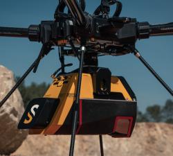
Easy mapping redefined Start your LiDAR journey with our easy-to-use Mapper system. Its low weight, mid-range capability, top-end point density and advanced accuracy and precision, make this LiDAR system the best value for money.
Evolve Dynamics - Sky Mantis UAS
Price: CALL FOR ASSISTANCE
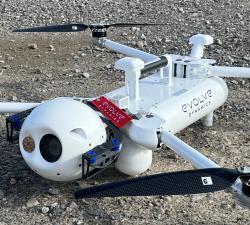
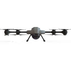
The Sky Mantis is an extremely capable UAS that has operated in the Temperate, Arctic and desert environments, in high winds and rain, both at sea and on land. It has been designed to support the defence sector, emergency services, search and rescue and other government agencies.
Fossils Stuff - Gravity 250-22
Price: CALL FOR ASSISTANCE
The Gravity 250-22 was Fossils Stuff evolution of the original Gravity 250. After popular request, the 250 was upgraded to 22** sized motors. The 250-22 is Fossils Stuff best selling frame after the FSGX 210.
Fossils Stuff - Gravity 280
Price: CALL FOR ASSISTANCE
The Gravity 280 FPV Racing frame has been CNC machined to the highest tolerances from two pieces of HDPE. This 6” frame must be one of the toughest racing frames on the market and comes with an optional Lifetime Frame Warranty*
Ukrspecsystems - USG-301
Price: CALL FOR ASSISTANCE
3-axis gyro-stabilized gimbal for multi-rotor drones. Equipped with 30x optical zoom Full HD camera. This payload is an ideal solution for drone inspections, industrial and security applications. USG-301 could be easily integrated with popular DJI platforms. Designed for multirotor UAV platforms.
AiDrones - AiD-H85
Price: CALL FOR ASSISTANCE
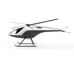
The AiD-H85 is a versatile RPAS (Remotely Piloted Aerial System) helicopter featuring an intermeshing double rotor design that does not require a tail rotor. This leads to an outstanding stability, reliability and an extraordinary lift capacity of 50 kg.
Air Control Entech - 3D Laser Scanning UAV
Price: CALL FOR ASSISTANCE
Our 3D Laser Scanning UAV is designed for precision, using a multi-purpose platform which has been specifically engineered to carry a FARO freestyle X Laser Scanner. Data integration with a ground scanner allows for Sub-3mm accuracy, enabling detailed re-engineering models to be created.
Ukrspecsystems - USG-252
Price: CALL FOR ASSISTANCE
This is 2-axis gyro-stabilized gimbal, which features Full HD day-view camera with 10x optical zoom and thermal camera. Ideal for applications where size and weight really matters. Designed for multirotor and fixed-wing UAV platforms.
Fossils Stuff - Thor X Class Racing Drone
Price: CALL FOR ASSISTANCE
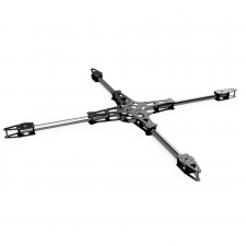
The Fossils Stuff THOR is an X Class Racing Frame with 800mm motor centres.Can be flown with up to 12S batteries for ultimate performance.
Terabee - TeraRanger Hub Kit
Price: CALL FOR PRICE
The TeraRanger Hub kit is an obstacle avoidance sensor and makes it easy to connect multiple TerRanger sensors to a single power and data hub and to integrate the data stream to your control platform. This is great for times when you want sensors simultaneously monitoring multiple axes.The kit enables you to plug and play with up to eight distance sensors and obtain high-speed distance data from each sensor.
AiDrones - Sonoboat
Price: CALL FOR ASSISTANCE
The Sonoboat is a cartographic surveying vehicle, capable of autonomous and remotely controlled operation. It is ideal for missions in hard to reach or dangerous locations. The ease of deployment and compact size significantly reduce the costs of waterbody mapping and similar applications.
Ukrspecsystems - USG-302
Price: CALL FOR ASSISTANCE
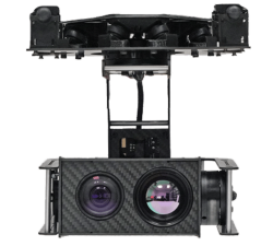
3-axis dual sensor gyro-stabilized gimbal for multirotor drones. USG-302 features 30x optical zoom Full HD camera and thermal camera with digital zoom. It can record video onboard and take still images. A perfect solution for the most popular commercial off-the-shelf drones. Designed for multirotor UAV platforms.
Fossils Stuff - S1
Price: CALL FOR ASSISTANCE
The Fossils Stuff S1 is Smoky FPV’s signature frame. At the end of 2017, it was clear that the Revo 5 was becoming less competitive although it had had a great season with some incredible results, it seemed that it was just not light enough! Smoky requested a lighter frame and with his valuable input we came up with the S1.
Fossils Stuff - Gravity 180
Price: CALL FOR ASSISTANCE
The Gravity 180 FPV Racing frame has been CNC machined to the highest tolerances from four pieces of HDPE. This frame must be one of the toughest racing frames on the market and comes with an optional Lifetime Frame Warranty.
Ukrspecsystems - USG-212
Price: CALL FOR ASSISTANCE
2-axis gyro-stabilized gimbal, which was designed for fixed-wing UAV platforms and small manned aircraft. USG-212 features Full HD day-view camera with 30x optical zoom and thermal camera with digital zoom.
Sky-Watch - Cumulus
Price: CALL FOR ASSISTANCE
Cumulus is an extremely easy-to-use and highly autonomous fixed wing drone built in first class materials for precision agricultural, mapping and surveying. The aircraft is made from the best carbon fiber and kevlar, which makes it one of the most robust UAVs on the market.
DPM Engineering - Titan F3
Price: CALL FOR ASSISTANCE
This fixed wing model has been specifically designed for extended mission duration while combining the hybrid functionally of a quadcopter configuration. This combination is greatly adapted to most mission requirements. It’s quality of build and operational features are world leading while offering an affordable solution to national and commercial organisations!
Terabee - Inspection Drone Kit
Price: CALL FOR PRICE
The TeraRanger Inspection Drone Kit is used for drone pilot aid and utilizes the small, lightweight (8g) and high-performance TeraRanger One distance sensor/s (8g) and a small electronics board to interface to the live analogue video feed. Drone pilots benefit from fast distance-to-target data being streamed to their live video feed to assist with complex flights in close proximity to potential obstacles and hazards.
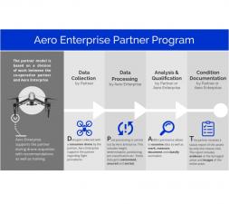
Aero Enterprise - Aero Enterprise Partner Program
Price: CALL FOR ASSISTANCE
The partner program is based on a division of labor between the co-operation partner and Aero Enterprise. The Partner uses his own conventional DJI drone equipment on site.
YellowScan - Fly&Drive - Fly when you can. Drive when you must.
Price: CALL FOR ASSISTANCE
A multi-platform LiDAR for geospatial survey scanning from air to ground.
FLY-R UAS - R2-240
Price: CALL FOR ASSISTANCE
The R2-240 was specially designed for extended range ISR operations. Like all aircraft of the R2 family it has the rhomboidal Wing aerodynamic configuration, which is a unique know how of FLY-R.The R2-240 is equipped with a Series Hybrid Propulsion and Power Generation system which allows long endurance missions with heavy payloads.Like the R2-150, the aircraft is fully autonomous and can be deployed from Land or Ship using the FLY-R Launcher and Automatic Recovery Systems.
Heven Drones - H250
Price: CALL FOR ASSISTANCE
The H250 will be the workhorse of Heven’s heavy lifting drones.
Percepto - The Percepto System
Price: CALL FOR ASSISTANCE
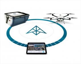
Percepto’s system consists of a weatherproof drone with HD RGB and thermal cameras, a base station for recharging and sheltering the drone and PerceptoCore software suite for flight management, data storage, report management, permissioned team access and computer vision and AI-powered applications. Percepto’s drone systems can be deployed standalone on a site, or as groups of multiple drone-in-a-box systems to meet coverage needs.
YellowScan - Voyager - Precision meets reality
Price: CALL FOR ASSISTANCE
The YellowScan Voyager is our highest range LiDAR solution with a range of up to 760m (2493 ft.)
Air Control Entech - Visual Inspection UAV
Price: CALL FOR ASSISTANCE
Our Livestream Visual Inspection UAV is our signature Visual Inspection technology, incorporating a real-time data link from UAV to onshore personnel for in-situ visualisation of the asset. Data is compressed and transferred via VSAT, enabling high-resolution live stream over a low-bandwidth connection. Data transfer via 4G networks is in development.
DPM Engineering - Titan M3
Price: CALL FOR ASSISTANCE
Whether you need a small, fast and easy to deploy UAV or a system that offers Long ranges and flight times for planned missions- Our range of Titan Drones are built to a very high level of quality with models of different sizes and specifications to offer solutions to meet your dedicated needs. We are always excited to embrace new and unique builds for your projects. This X4 configuration of Quad Copter has been specifically designed for: Security & Surveillance
Aero Enterprise - Aero-Software Package
Price: CALL FOR ASSISTANCE
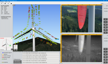
The self-developed AERO-Software Package enables an efficient asset management with AERO-View - for a preview of the results – and AERO-Lyse – for allocation of anomalies, assessment of damages and documentation.
Valqari - Valqari Single Locker (DevKit) Drone Delivery Station
Price: CALL FOR ASSISTANCE
The Valqari single locker (DevKit) drone delivery station, enables full autonomous point-to-point private delivery. The station accepts packages delivered via precision landing, hover drops and winches.
Air Control Entech - Ultrasonic Inspection UAV
Price: CALL FOR ASSISTANCE
Our Ultrasonic Inspection UAV is engineered to produce repeatable readings. Powerful electromagnets enable the UAV to attach and lock on to infrastructure, stabilising the platform and ensuring the capture of accurate UT readings. Reduced power consumption allows for an extended utilisation of up to 6 hours.
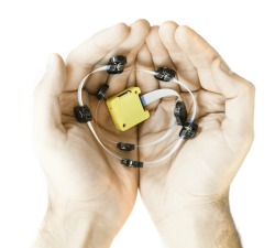
Terabee - TeraRanger Tower
Price: CALL FOR PRICE
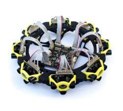
With zero moving parts, TeraRanger Tower is a silent & reliable alternative to rotating LiDAR scanners for navigation and obstacle avoidance. It combines 8 TeraRanger One sensors in a circular array and the TeraRanger Hub to create a lightweight, fast (up to 270 Hz), and eye-safe scanner. Calibrated distance data is streamed from a USB or UART port as an array of synchronized distances, in millimetres.
Terabee - TeraRanger Evo 60m
Price: CALL FOR PRICE
TeraRanger Evo is the long range distance sensor of the TeraRanger family and is ideal for reliable altitude control, terrain following and anti-collision, both indoors and outdoors. Using LED Time-of-Flight technology (rather than lasers) the 9-gram distance sensor can measure distances up to a 60-meter range! In addition to its long-range capability, it has a modular two-part design, supporting a wide range of power, communication and connector options without additional cables.
Fossils Stuff - Gravity 250
Price: CALL FOR ASSISTANCE
The Gravity 250 is Fossils Stuff original High-Density Polyethylene (HDPE) racing frame and the first frame in the UK to be made from this incredibly tough material. Many hundreds of these frames have been sold to date.
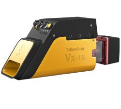
YellowScan - Vx15 - Made for adventurers
Price: CALL FOR ASSISTANCE
Go from mapping inaccessible sites in the Balinese mountains to secluded areas in Chile.
AiDrones - AiD-MC8
Price: CALL FOR ASSISTANCE
The AiDrones AiD-MC8 unmanned aerial vehicle is an exclusively commercial project aimed primarily at civilian applications. In fact, the drone AiDrones AiD-MC8 is positioned as an industrial unmanned aerial vehicle. However, due to the rather wide scope of this device, it can be used for aerial photography and aerial photography, used for monitoring the environmental situation, applied for cartography and topography, For geological and geodetic exploration, etc.
Ukrspecsystems - PC-1
Price: CALL FOR ASSISTANCE
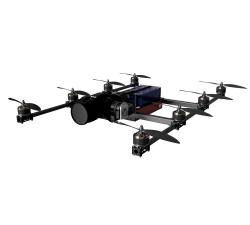
Our PC-1 VTOL drone features extremely durable airframe made of carbon fiber. Its eight rotors design offer maximum reliability in any wether conditions and environment. No matter when or where you will use our drone it will always do the job.


